IST - Monday, April 13, 2026 6:57 pm
Hot News

DMRC Partners with Mappls to Enhance Metro Travel Experience Breakthrough

Soniya Gupta

Updated on:

DMRC

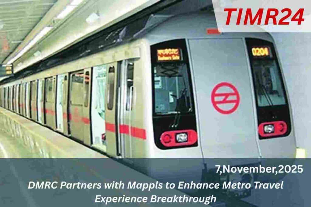
The Delhi Metro Rail Corporation (DMRC) has partnered with Mappls MapmyIndia to integrate its API with the Mappls App. This collaboration aims to provide over 35 million users with comprehensive metro-related information, enhancing commuter convenience in the Delhi-NCR region. Users will access details on nearby stations, routes, fares, train frequencies, and estimated (Railways) travel times. The initiative promotes open and user-friendly travel information, while the app also facilitates locating nearby government services and reporting real-time issues like traffic congestion. This partnership highlights DMRC’s commitment to improving urban mobility through technology.

From the moment DMRC put into motion the idea of transforming metro-commuting in the National Capital Region, one of the big challenges remained how to present reliable, real-time information in a user-friendly way. The recent Memorandum of Understanding (MoU) between DMRC and Mappls marks a significant milestone in that journey. Under this agreement, the metro operator’s rich transit data will be integrated with Mappls’s digital mapping and navigation platform enabling commuters to access station locations, route options, interchanges, fare estimates, train frequencies and travel-times through the app.

DMRC has been striving to improve urban mobility, reduce last-mile gaps, promote modal shifts, and enhance commuter experience. On the other side, MapmyIndia Mappls app has emerged as one of the leading geo-location mapping platforms in India. The partnership is rooted in the desire to combine DMRC’s transit-specific data with Mappls’s mapping technology to create a more seamless, digital travel experience for metro users. Through the MoU, DMRC’s API will be ingested into the Mappls platform Once fully implemented, this collaboration promises a host of benefits for passengers of the Delhi Metro network: via Mappls, commuters will be able to locate nearby metro stations.

Why it matters Convenience Planning & time-saving

Interchanges, estimate the fare for a given journey, check train frequencies and estimated travel times all within one interface the app will extend beyond just metro navigation: features such as reporting traffic congestion, parking issues, water-logging or other civic problems are also baked in, therefore blurring the line between commuter transit and urban mobility/ civic-engagement functions For a daily commuter, Metro travel frequently involves uncertainty such as “which interchange to take?”, “how long will the wait be?”, “what’s the best route to my destination?”, “what will the fare be?”. By making all that information readily accessible via Mappls.

The partnership allows travellers to plan better, make more informed decisions and reduce wasted time. DMRC’s Managing Director remarked that the integration would make “travel across NCR smarter, seamless enabling commuters to plan better, navigate easily, and save time fact, the integration is being flagged as a step toward a “smarter, safer and more connected public-transport ecosystem Under the MoU, DMRC will provide the necessary API access to its metro data streams covering station details, routes, line interchanges, frequency, fares and estimated travel times. Mappls will consume that data and embed it into its mapping/multi-modal transport layer.

35 million users of the Mappls app will thereby gain access to the enriched metro dataset The “multi-modal” nature is key: beyond the Metro, Mappls intends to integrate adjacent first/last-mile and surface-transport options, thus enabling commuters to plan journeys that span multiple modes. Mappls’s public-engagement platform will also capture user-reported feedback (for example, water-logging, parking shortages, incidents) which will be routed to relevant authorities, thereby enhancing responsiveness and infrastructure-planning This collaboration is more than just another app feature it reflects a broader trend in urban mobility where transit agencies partner with digital platforms to unlock data.

Urban mobility and the broader ecosystem

Enhance transparency, and deliver traveller-centric services. The Metro system is no longer just physical infrastructure but part of a digital ecosystem where way-finding, journey planning, real-time updates and civic interaction converge. By combining DMRC’s transit data with Mappls mapping and crowd-sourced civic-feature layers, the hope is to create a “smart city” transport service. Indeed, in press releases MapmyIndia emphasises its role in supporting India’s vision of an “Atmanirbhar Viksit Bharat” through indigenous technology For the Delhi-NCR region including not just Delhi, but its satellite towns and suburbs the improved metro-information availability means that even occasional.

New commuters can navigate the system more comfortably. For example, knowing exactly which interchange to take for a given destination, or what the estimated travel time is, or what the fare will be, can reduce anxiety and encourage usage of the metro system over private vehicles. This in turn has positive side-effects: lower congestion, reduced pollution, better utilisation of public transport asset. Because the Mappls app is already widely used, the network effect means that knowledge gained by one commuter can benefit many (for example, via visibility of reported incidents or issues). The collaboration thus acts as a catalyst to raise the overall standard of urban mobility across the region.

Challenges and implementation considerations

Of course, no technological integration is without its challenges. Some of the key considerations here include the accuracy and timeliness of the data, the user-interface design of Mappls when handling large transit networks with frequent changes, and the ability to maintain coherence when multi-modal journey planning Additionally, user education is important many commuters may still rely on traditional methods (station signage, announcements) and may need to be encouraged to use the app for planning ahead. Privacy and data-governance considerations also come into play when user-reporting of civic issues is enabled in the platform. DMRC and Mappls will need to continue refining their data-sharing.

Update-mechanisms and feedback loops so that the offering remains robust as the transit network grows or changes this partnership sets a template for future collaboration between transit agencies and digital map/transport-platform providers. As DMRC expands its network data-wiring done now will pay dividends in scaling to new stations and lines the Metro-integration opens the door to deeper multi-modal journey planning (for instance, integrating bus, last-mile e-vehicles, ride-share) and broader features (such as live crowd-density information, predictive arrival times, accessibility features for differently-abled.

The framework could also be replicated by other metros in India, where local transit operators partner with digital platforms to enrich commuter experience. In that sense, the collaboration could influence transport-tech development in other cities beyond Delhi-NCR In summary, the MoU between DMRC and Mappls marks a significant step in the evolution of metro travel in the (MMRC) Delhi-NCR region shifting from static route maps and station signage to a full-fledged digital journey-planning experience. By unlocking DMRC’s transit data and embedding it into Mappls’s mapping platform, commuters gain better visibility.

Greater convenience, and more control over their travel. The initiative aligns with broader goals of smart-mobility, urban digitalisation and citizen-centric services, and has positive implications for travel-time savings, modal shift, and civic engagement. As the Metro network continues to grow and mobility demands evolve, the partnership presents a promising foundation for smarter, more seamless urban transit.

Q1. What is the nature of the partnership between DMRC and Mappls?
The Delhi Metro Rail Corporation (DMRC) has signed a Memorandum of Understanding (MoU) with Mappls (also known as MapmyIndia) to integrate the metro’s live data such as routes, fares, train frequencies and travel times into the Mappls app.

Q2. Which data will be available to commuters through this integration?
Commuters will be able to access metro station locations, route maps, fare information, train frequency and travel time estimates within the Mappls platform.

Q3. How many users of the Mappls app will benefit from this integration?
The Mappls platform already has more than 35 million users, and these users will gain access to DMRC metro-data once integration is live.

Q4. What are the wider implications or advantages of this collaboration?
This integration supports smarter travel planning (one app offering multi-modal transport info), enhanced commuter convenience, quicker navigation between metro lines, and stronger citizen engagement through app-based real-time issue reporting (such as congestion or waterlogging.

Q5. When will the data integration be implemented and available to commuters?
While the MoU has been signed, the rollout exact schedule is subject to technical integration and testing. The announcement indicates the next phase of deployment across the Delhi-NCR network.